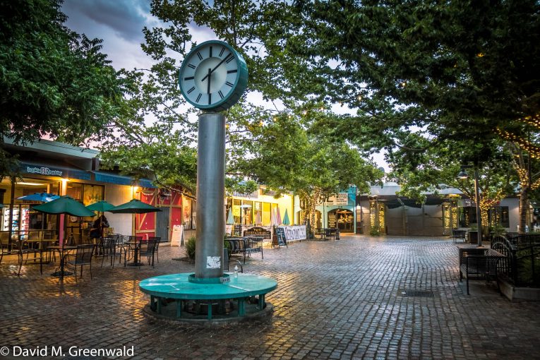
One of the big questions facing the community as we draw to the end of the current RHNA (Regional Housing Needs Allocation) cycle is where housing will go in the future, given limitations on developing on the periphery. One of the thoughts then is that the densification of the Davis Downtown, and the addition of housing units there, would help the city meet its future RHNA goals.
In the meantime, as DPAC (Downtown Plan Advisory Committee) meets this week for the first time since February, staff is asking for recommendation on the Option 1 map, which establishes the zones in the Form-Based Code, and which will replace the existing zoning in the downtown area.
Staff is asking the DPAC members to make a recommendation on each item that could produce adjustments in the overall city plan for the downtown.
There are seven such recommendations. First, they recommend designating G Street between 2nd and 4th as Main Street Large.
They note: “A number of properties within the proposed Main Street Large zone have been recently developed or improved or are historical Landmark sites and are not likely to be redeveloped.”
However, they note, it also “offers additional opportunity for redevelopment and greater development intensity.” The area is part of the city’s traditional commercial district and includes a number of large parcels. “The G Street area is proximate to the Amtrak station, a major community transportation asset. Staff feels that greater intensity and density should be allocated in the  downtown plan near the station to promote transit-oriented development.”
Staff adds: “The G Street area offers some of the greatest potential for redevelopment given that several parcels include lower intensity buildings that have depreciated over time, larger parking lot fields, and several of the parcels are larger and/or under single ownership.
“The G Street area is envisioned to be a mixed-use flex district within the Draft Downtown Plan.”
Second, the recommendation for 3rd Street from A to B Streets is Neighborhood Medium. They argue this would provide more consistent zoning along 3rd Street, similar to existing zoning, and standards for height and mass would be similar.
“The Form Based Code provides greater certainty for developers and residents in terms of process and building form,” they write. “The inclusion of this area will allow for potential development to be analyzed in the Environmental Impact Report for the Downtown Plan rather than having to analyze future projects on an individual basis.”
Third, the proposed zone for the Davis Commons site is either Main Street Large or a combination of Main Street Large and Neighborhood Large. Staff believes this would limit flexibility for the redevelopment and reduce the commercial area and uses from the current zoning.
Fourth, they would combine the Neighborhood Medium zone with the Neighborhood Medium Open zone. Currently, they differentiated by their allowed uses. Neighborhood Medium is primarily residential with limited commercial or office uses.
Neighborhood Medium Open would allow more commercial and office uses. The existing Mixed Use zone would additionally allow a greater range of uses than currently proposed for the Neighborhood Medium.
Fifth, they are recommending adding the parcels along University behind Black Bear Diner to the plan with the Neighborhood Medium designation. They note that the owner of the apartments at 204 University is interested in redeveloping the building but has been advised to wait and participate in the Downtown Plan.
Staff notes: “The inclusion of this area will allow for potential development to be analyzed in the Environmental Impact Report for the Downtown Plan rather than having to analyze future projects on an individual basis.”
They add: “A key objective in updating the plan is to streamline process and provide certainty; inclusion of this area would be consistent with that objective.”
Along similar lines, they would consider designating parcels in the University Rice Lane Neighborhood as being within the Downtown Plan with the same Neighborhood Medium designation.
Finally, they recommend allowing greater development opportunity at the block of G Street between 4th and 5th.
The sale of the Hibbert Lumber parcels could provide a promising future redevelopment opportunity.
Staff writes: “Adding an opportunity for this block to increase in height from what it is currently being designated in the anticipated draft regulating plan could provide for more viable redevelopment opportunities for the site.”
There are a few other key points.
First, they clarify height limitation. They note some confusion about height limitations for the Neighborhood Small zone.
They write: “At the last DPAC meeting there was some confusion about whether this designation allowed for 3 or 4 stories. Staff recommends that retaining the allowance for a 4th story with appropriate setbacks as an important feature of the plan to increase potential feasibility of future redevelopment opportunities.”
In October, DPAC recommended a series of sustainability goals for the downtown plan. They note here: “The City continues to pursue sustainability goals on a city-wide level with on-going efforts in a number of different areas. Sustainability should be integral to development of the downtown area, which can serve as a model of sustainability.”
However, “sustainability efforts in the downtown area need to be consistent with overall City policies and goals focusing on sustainability, which would be established in upcoming General Plan Update, as updates to existing plans such as the Climate Action and Adaptation Plan, and through adoption of potential new plans and requirements focused on energy, water, waste, transportation, and other specific areas.”
There has already been discussion about affordability within the framework of the council’s update on affordable housing requirements in the core, and staff here notes that such needs will be included in the Draft Downtown Specific Plan.
Finally, they have a draft of parking-related goals including: managing curb parking and city-owned lots and garages, changes to private development requirements – including the removal of minimum parking but the creation of maximum parking requirements.
In addition, they look to improve transportation choices, including:
- Strengthen Davis’ regional Transportation Management Association.
- Establish deep-discount group transit pass program.
- Review and expand local transit networks.
- Continue improving bicycling facilities and programs.
The next DPAC meeting is set for June with discussions about the release of a public Draft Downtown Specific Plan with a 90-day public review period.
—David M. Greenwald reporting


Removal of parking minimums and implementation of parking maximums is as basic as clean water.
I appreciate very much the transportation aspects mentioned, and in relation to regional we really need to sort out a way to get fares way, way down on Capitol Corridor for trips between Davis and Sacramento – at least for times when there’s more capacity, such as late evenings and weekends, and for very small groups, and also spontaneously… focused on eating out, entertainment and – seriously – having romantic etc. partners in the other town. How this benefits (the residents of) both cities can be looked at as competition, but it’s more about marketing and seamlessness. Imagine various regional pass packages that allow four or five people – i.e. a carload – to travel together inexpensively with – unlike now – no advance purchase necessary – a two-for-one pass for train + bike share.
Right now an Uber + tip from Davis Depot to Sac Valley Station is about $25 one-way. It’s $27 for three full-price train tickets. That’s crazy! (Yes, Lyft/Uber drivers in the SACOG area should have a min. wage after expenses just as in SF… this should help raise rates to reflect the real cost and increase equity for workers… or TNC’s will vanish as the VC goes elsewhere and we’ll just have private cars and the train – and the slow bus – again.)
It still really sucks to live in Davis and not have your own car, or easy access to one through a parent or partner. Carshare is so far only good for quick round trips (Gig and Zipcar don’t have one-way options in this region, at least not yet.) More solar and more electric cars will only make the train seem more expensive in comparison. The train also leaves on the edge of Sac Downtown whereas a car can get one directly to Midtown or wherever, sometimes with free parking. The distance from the Sac Valley Station platforms to where bike share bikes are currently accessible is not much shorter than the walk from Davis Depot to E St. Plaza. This is a huge advantage for Davis, but then also in the near future Sacramento will have an expanded waterfront a few minutes by bike from the train station there.
The region should support very cheap regional transport – or just a region-wide pass – that makes a choice to go out or make out in Davis or Sac not dependent on money or owning a car… just a bit about time. If done well – with smart partners at venues – a lot of people will travel in both directions!
For students without a car – it’s not too bad. Biking is easy. Unitrans is free and convenient. The few times I need to get a lot of things you can do Lyft or Rideshare.
Say WHAT? I believe the train portion is $10, much less if you buy a ten-ride or monthly. I have taken Lyft from Dowtown Sac to Davis for under $25.
The train ticket price is for someone who doesn’t work in Sac or wants to be restricted by the time and other limits on the ten-ticket book.
A couple months ago I missed by less than ten minutes the 9am Thruway bus from Davis to Sac. I tried calling my roommate; no answer. I then downloaded the Uber app to my phone, connected my credit card, got a car within about 5 minutes, drove at legal speeds to Sac Valley Station… and made the Thruway bus that was connecting to the San Joaquin train in Stockton…. $20 (on “the clock”) + $5 as I was headed to a funeral the next morning in L.A….. in other words outside of weekday commute hours it’s generally so easy to get to and from Sac by car quickly and so on…
The true cost of that ride by car should be much higher, and I think it is fair to say that the Capitol Corridor ride cost is reasonable given the valued labor on board and other factors, including the expensive-to-run heavy Diesel-powered loco pushed and pulled train cars. Regional actors can only do so much to responsible-ize the cost of driving – e.g. a toll on the Causeway, or higher fees for parking – so in the meantime they should work out a deal with Amtrak and Capitol Corridor to heavily subsidize fares within the region that would otherwise be done easily by car… during the times I mentioned.
Years ago I suggested something generally-similar – a cheap ride within Alameda County between Berkeley Amtrak and Jack London Square Amtrak – or Coliseum – that would also be WAY faster than BART – but was told that it wasn’t the purpose of Cap Cord to do trips like this, plus everyone has to have a registered ticket due to Amtrak rules…. all impediments to sustainable local transport. I am not sure how to solve that, except that we have to!
While we have not actually built student housing yet, given the approvals right now I would say the biggest needs are housing for young workers who want to work and stay in Davis and economic development to get us jobs. This could help with both if don’t correctly. We have to be willing to grow up since we won’t grow out.
This proposal put forth by Staff following the efforts of the DPAC is a huge disappointment. Instead of using the opportunity to reimagine the downtown in ways that will help meet the fiscal and housing needs of the community, what we have a plan the codifies the status quo. What a waste of time, talent and resources. Switching to form-based codes is a fine idea, but this implementation is simply an extension and really an expansion of our existing restrictive zoning. All of the downtown core should be zoned mixed use for maximum flexibility going forward, with more generous height restrictions than currently proposed. Use the form-based codes to direct the mass and design of the buildings, not what goes on inside those buildings.
Mark West said: “All of the downtown core should be zoned mixed use for maximum flexibility going forward, with more generous height restrictions than currently proposed. Use the form-based codes to direct the mass and design of the buildings, not what goes on inside those buildings.”
..and “The logic behind form-based codes is to control the appearance of the development, not what goes on inside.”
Time to study up on form-based codes (FBC) and correct Mark’s misconceptions! From the Form-Based Code-Institute (FBCI) “Misconceptions About Form-Based Codes” https://formbasedcodes.org/articles/misconceptions-form-based-codes/
[For the misconception that “FBC isn’t zoning and doesn’t address land use]: “If your FBC doesn’t directly address allowed land uses or clearly rely on other land use regulations, it is an incomplete FBC.”
[For the misconception that FBC requires mixed-use in every building regardless of context or viability]: “FBCs identify the components; it’s up to the community to choose which components fit best and are most viable in each context.”
Perhaps one of us is misreading this – but it looks like the entire downtown is zoned for commercial, where the residential is the areas outside of what we would think of as downtown – i.e. University and Rice Lane.
University and Rice lane are part of the downtown core and were never intended to be a ‘neighborhood.’ The area between the University and B street is ideal for high-rise student housing as was envisioned in our first CASP, putting the mass of students living near our commercial core. In my opinion, the zoning should reflect a future transition of use for this area.
But they are limiting the types of commercial that are allowed in certain areas, hence more restrictive zoning. They are also adding height limitations that do not currently exist downtown. We should be using this opportunity to create an expansion of flexibility in our land use downtown, not to increase the restrictions.
While I can see that as a possibility, I can see why they might not. Seems like a point you could make the DPAC.
In terns of the restrictive zoning, that’s not my read. Can you show what I’m missing there?
Some of the zone definitions specify what types of commercial are allowed. That is an unnecessary restriction. We are very poor at predicting future needs so when we put restrictions in place we inevitably restrict the potential for a site. It also sets up an opportunity for another expensive lawsuit when someone disagrees when the CC uses its discretion to alter the original intended use. Why put the restriction in place at all?
The logic behind form-based codes is to control the appearance of the development, not what goes on inside. A good example to explain this was the Hyatt House project. The South Davis Specific Plan (and the EIR) called for a line of 50′ tall commercial buildings lining the freeway to act as a sound barrier for the neighborhoods to the south. The purpose of the design was to reduce noise pollution from the freeway in the residential area. Unfortunately, the City tried to predict what types of businesses should be allowed in those buildings, putting in place restrictions that resulted in no development at all, and hence, no sound wall. When the hotel was proposed it did not fit within the specific restrictions for the parcel, leading to unnecessary hand-wringing over the proposed 50′ tall building, ultimately reducing the number of rooms in the project (and future TOT revenue) and setting up an expensive lawsuit which the City then lost. All of that could have been avoided had the City not placed restrictions on the types of businesses that were allowed in the commercial zone in the first place. They are proposing repeating the mistake again.
OK… There is a SP/Visioning Plan for the A to B, First to Fifth Area… City has/is spending a whole lot of $$ for roadway, utilities, etc. in that area, over the past few years…
The plan calls for ‘densification’… Central Park West, and Mission Residences were the first…
Not unlike State College/University Park, PA… should be ‘sibling-cities’… same land-grant college thing, same growth and town/gown issues… they have tracked similarly since the 1930’s… population and quality of life… the late 1890’s, early 1900’s SF house Dad grew up in (College Avenue… think Russell Blvd… immediately across the street from ‘campus’) is now a three story (primarily student) apartment complex…
Was last there in 2002… still the community I remember visiting for 50 years… changed, but the same…
Just saying… “community” is not necessarily same as ‘buildings’… “community” is far deeper… attitude, friendliness of the residents… no matter how many…
https://en.wikipedia.org/wiki/State_College,_Pennsylvania#Local
The Design Guidelines and those who had input into them (including me) sure don’t see it that way. While I respect your right to have a differing vision, “never intended” isn’t exactly an objective vies.
The design guidelines were simply another layer of restriction put in place to limit develop, by those looking to protect their ‘little slice of heaven’ from ever changing or evolving (at least in their lifetimes). They were a continuation of our protectionist approach that frankly should never have occurred. That said, I will concede your point.
MW, really not true. DGs were put in place to guide how development would occur. And thanks for conceding my point. I know you don’t agree with any such restrictions. There are many of us who see value in how a neighborhood evolves, and in respecting the history of older neighborhoods. DGs are not ‘no growth’ by any stretch. They are quite apart from what many developers would like to see — thus the reason for their existence.
I don’t have a problem with that. I think that if you need to add a design guideline then the underlying zoning/planning is at fault and instead of investing time and resources into a DG we should have redone the CASP/GP instead. That was especially true with the DG for the downtown that was at times not in agreement with the underlying plans, which resulted in unnecessary problems and costs for the community.
From the Form-Based Code-Institute (FBCI) “Misconceptions About Form-Based Codes” https://formbasedcodes.org/articles/misconceptions-form-based-codes/
[misconception]: FBC can’t work with design guidelines, and complicates staff review of projects.
“Because conventional zoning doesn’t ask a lot of questions, most planners have had to learn what they know about design on the job, and need design guidelines to fill in the gaps left open by the zoning. That’s how I learned. A well-prepared FBC doesn’t need design guidelines because it explicitly addresses the variety of issues through clear illustrations, language, and numerous examples. However, we are not allergic to design guidelines; the key is to make sure that the guidelines clarify what is too complex, variable, or discretionary to state in legally binding standards.”
Thank you for your (singularly focused) input, Rik. Appreciated… truly.