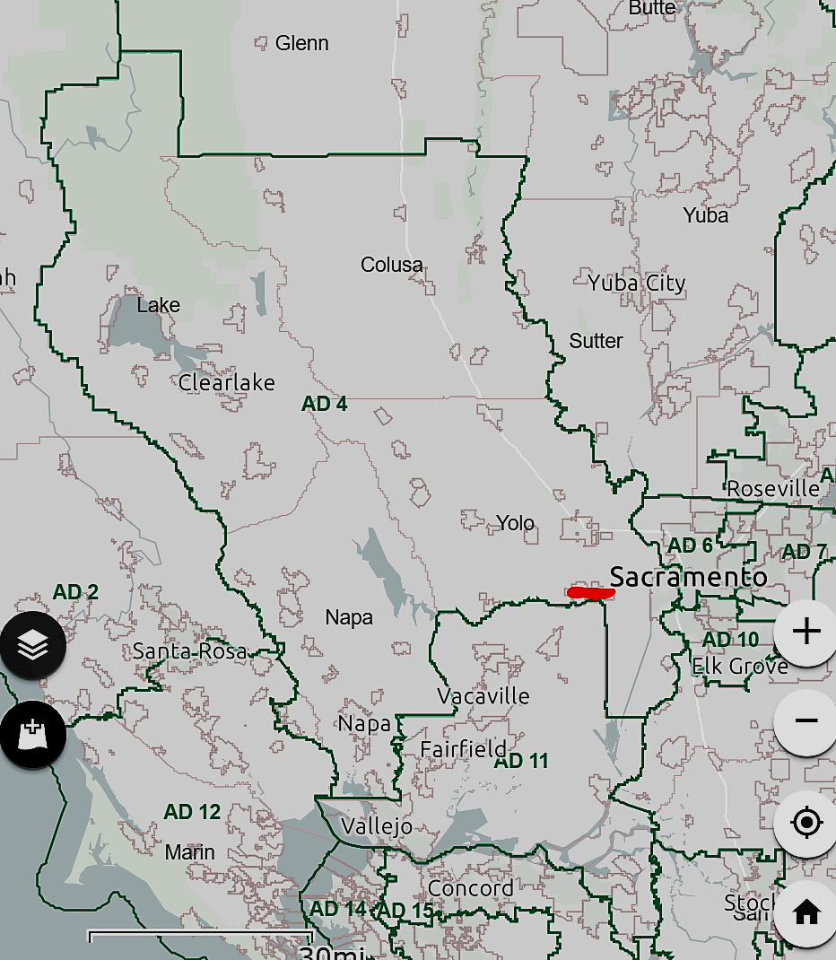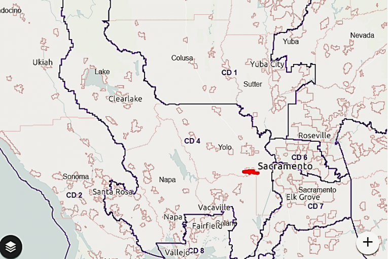
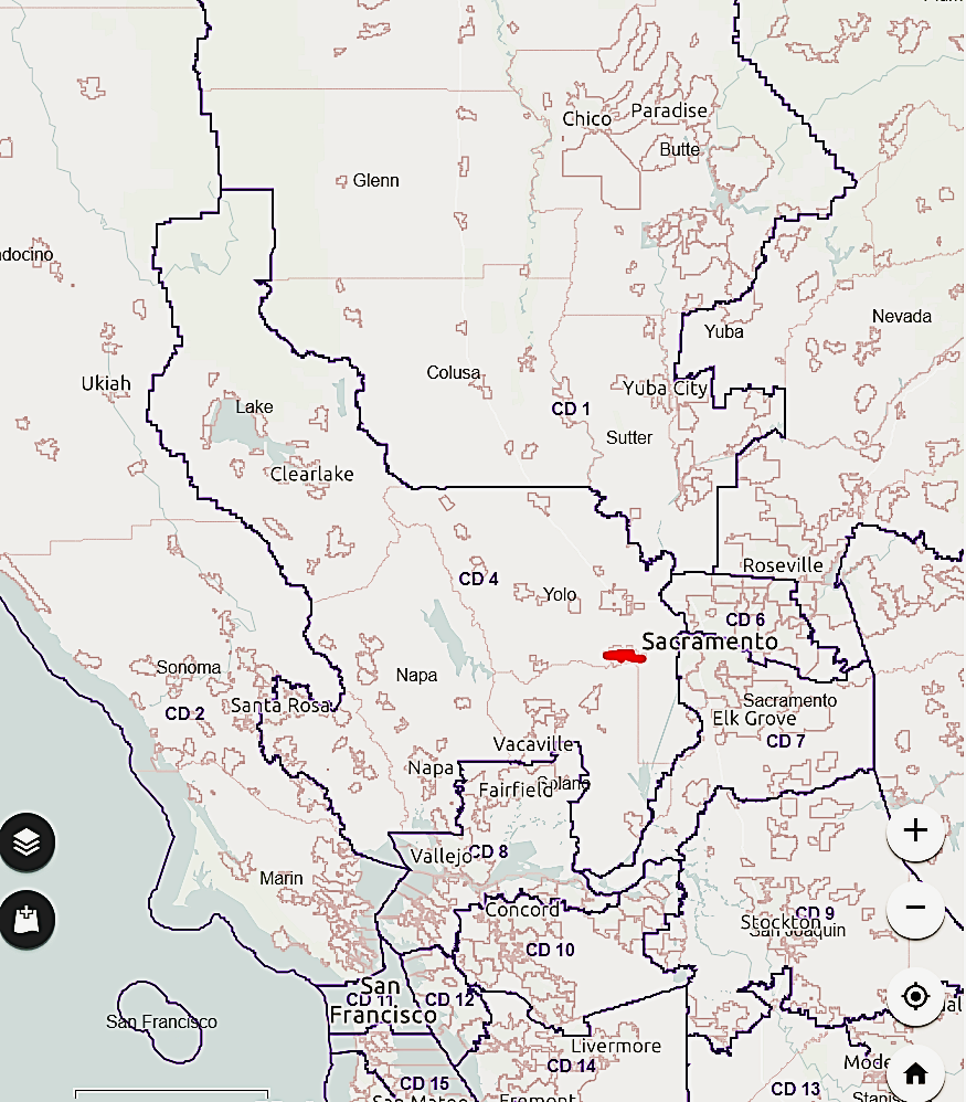
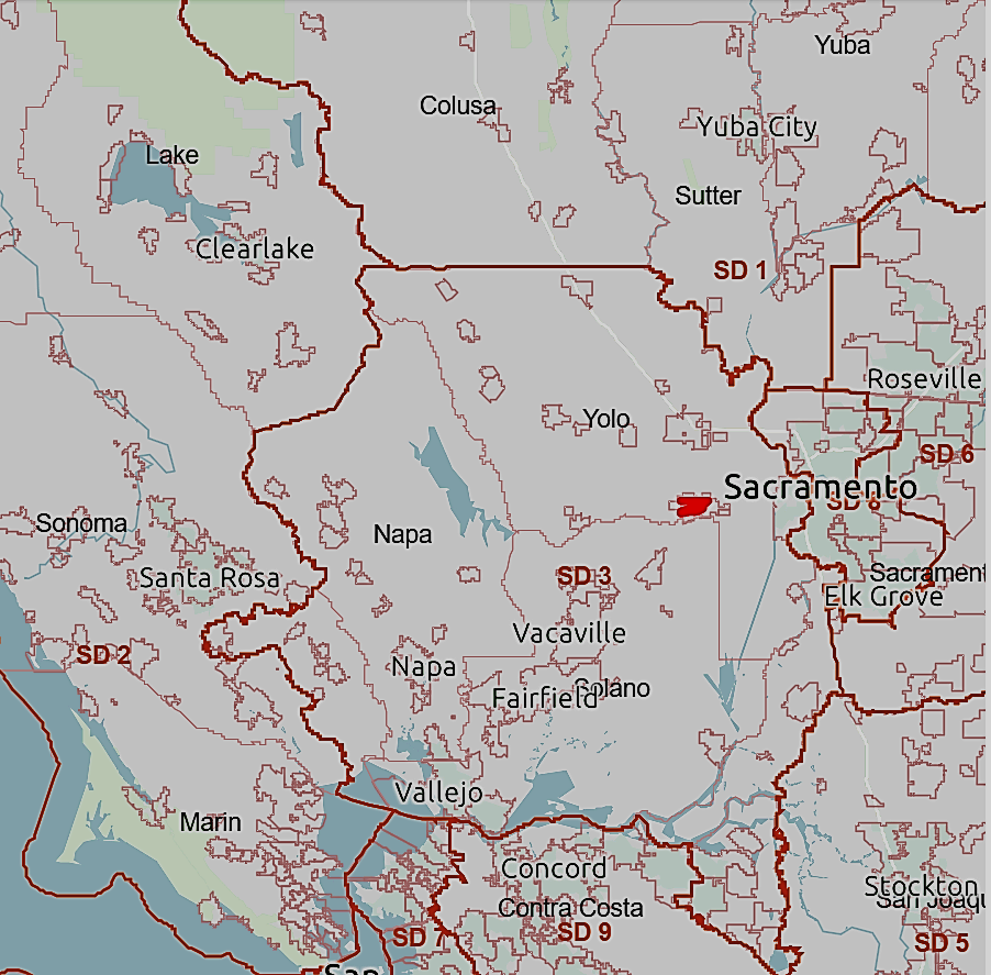
Submitted by Alan Hirsch
These are screen shots for a quick look at the new redistricting maps. I have marked with “red” where Davis is. Davis is in the same district as Woodland, West Sacramento and Winters in all maps except the congressional map, where West Sac is in CD 7 grouped with Cities of Sacramento & Elk Grove.
Links For a deeper dive:
- You can explore entire state and zoom in and out on actual final map using tool found at:
https://www.wedrawthelinesca.org/final_maps?utm_campaign=final_maps&utm_medium=email&utm_source=ccrc
Map also give ethnic makeup of each district in the metadata if you hover over the map. - General CalMatters article on California redistricting was reprinted in Enterprise is found at this link: https://www.davisenterprise.com/news/local/state-government/state-commission-approves-final-redistricting-maps/
- Article about relocation of Davis to new congressional district in Enterprise found at this link: https://www.davisenterprise.com/news/local/davis-jumps-districts-on-new-congressional-map/.
Maps below have district line on base map that shows county lines, city borders as well as reservoirs, lake and bay shown. Davis marked with Red.
Map 1: New US Congressional districts—Davis is losing John Garamendi and moved into Mike Thompson’s Congressional District 4; Thompson is also a Democrat.
Map 2: New State Senate Districts boundaries:
Map 3: New Assembly District boundaries